

Kagehinata (Sunlight & Shade)
Sunlight and shade for any home, right on the map.
An iPhone app that shows the sun’s direction and height and the shadows of nearby buildings at a glance
View on the App Store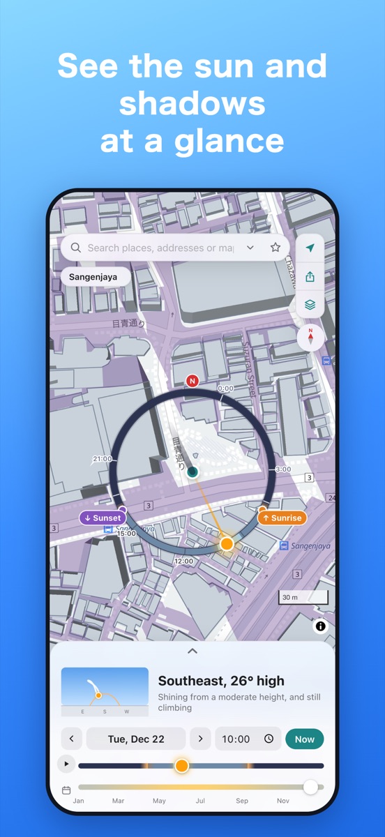
Features
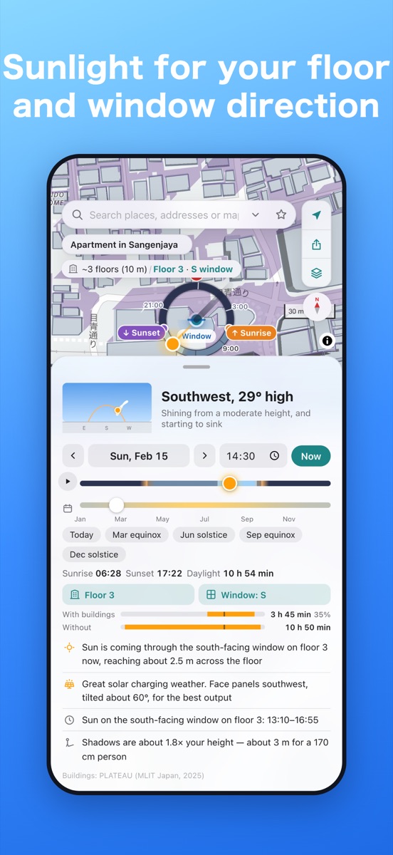
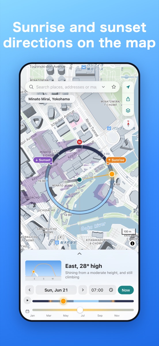
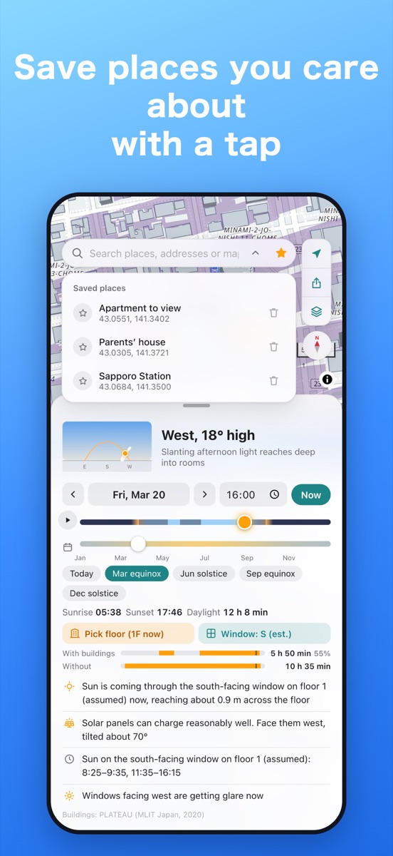
The sun and shadows at a glanceTap the map to see the sun’s direction and height, and which way and how far shadows fall.
Shadows of nearby buildingsZoom in to see building shadows on the map, whether a spot is in sun or shade, and which hours it gets sunlight. Compare sunlight with and without buildings.
Your floor and windowCheck sunlight for a specific floor and window direction. The window direction is estimated from the building’s shape, and slopes and nearby hills are taken into account.
Any season in a tapChange the time and date with sliders, or jump to the equinoxes and solstices. Drag the sun on the map, or play the day from sunrise to sunset.
The sun as you see it in the skyToday’s sun path from where you stand, and the sun at the same time over a year (the figure-eight analemma).
Friendly commentsSuch as “Your shadow is about 1.6 times your height” or how far sunlight reaches into a south-facing room, with the weather forecast in mind.
Point your phone to find the sunTurn on the compass to see the way you face on the map and where the sun is.
Works offlineSun calculations, station and town search, and a simple map run on data stored on your device.
Solar panel chargingFrom the sun’s height, cloud cover and building shadows, see how well a panel would charge and which way to point and tilt it.
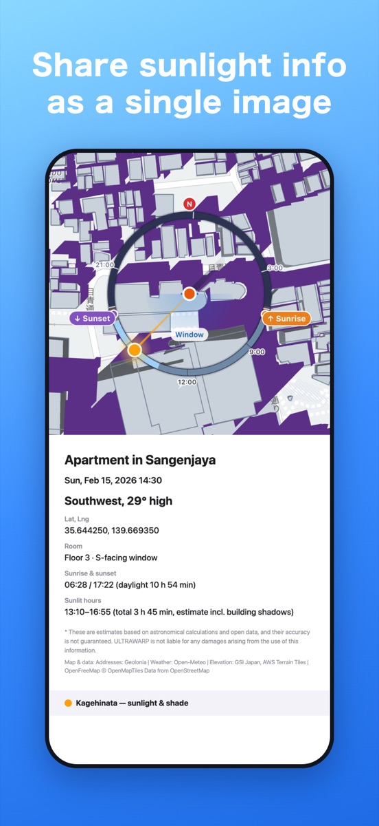
Share sunlight infoSend the sunlight for a place (coordinates, sunlit hours and weather) as text or a single image. The shared link opens the same place and time.
Send places from map appsUse the Share button in Google Maps or Apple Maps to send a place straight to Kagehinata.
No account neededYour location and saved places stay on your device. Available in English and Japanese.
Great for
- Checking whether a south-facing room gets sun even in winter, before you visit a home
- Knowing how harsh the afternoon sun is and until when a place gets sunlight
- Planning a balcony, laundry or a small garden
- Finding golden hour and sunset directions before a photo walk
Sun positions are astronomical estimates. Building shadows are approximate, based on open data from PLATEAU 3D city models (Japan) and OpenStreetMap (elsewhere), and need an internet connection; shadows from trees are not included. Building shadows can be turned off in Settings. The information shown is an estimate and its accuracy is not guaranteed. See the disclaimer on the support page for details.